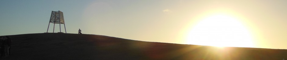
For every Peace Corps Volunteers in Nicaragua there are a few pilgrimages that we need to make. Pilgrimage implies sacrifice. Suffice to say, all of our pilgrimages involve long travel and sometimes shelling out a bit of cash. Most Volunteers make their alms with the volcano gods by trudging up Cerro Negro and boarding down its volcanic ash. Many Volunteers make the annual pilgrimage to Ometepe Island for the Fuego & Agua race, which is a 50k. And then there is the pilgrimage to the Caribbean Coast – the other Nicaragua.
The never-ending saga of the transcontinental canal should remind you that Nicaragua is a country that spans the Mesoamerican isthmus. Nicaragua has a Pacific and Atlantic coast. Specifically, the Atlantic side is the Caribbean Sea. The Atlantic is separated from the Pacific by jungle, and the majority of the population lives on the Pacific side of the country. The Atlantic Coast is worlds apart, and a true schlep to get to. I made my pilgrimage last week.
At this point, as you may have noticed in the usual pattern of my blog posts, I am going to go into the historical and cultural background on the Caribbean Coast. However, I feel that it is necessary to put in a disclaimer. History can be written by the winners, and I am no expert on the true reality of the Caribbean Coast. I may inadvertently misconstrue reality or even relate history as it did not happen. But rest assured that as always, my goal is the truth, and I tell these stories with no opinion of my own, except for my own personal experiences, which pale in comparison to families whom have lived on the coast for countless generations.
The Caribbean Coast has been inhabited for thousands of years by indigenous Mesoamerican peoples. The dominant tribe was the Miskito (which, depending on who you ask, may or may not be the origin of the word mosquito in the English language), and the Rama and Mayanga were subordinate tribes. They occupied all the lands of the coast and the interior rain forests, primarily along the large rivers, such as the Escondido, the Matagalpa, and the Coco, that spill out in the lagoons of the Caribbean. And so they lived for thousands of years.
In 1502, on his fourth voyage to the New World, Columbus himself explored the Miskito Coast (another name for the Caribbean Coast of Nicaragua). However, for centuries the Spanish failed to exert influence. Instead, British and Dutch privateers exploited the lagoons of the coast for refuge. Over time, this British exploitation morphed into a British protectorate over the coast, directed against the Spanish. The British recognized the Miskito King, who “reigned” over the territories from Pear Lagoon.
The British established plantations along the coast, especially for mahogany timber. In came the African slaves. To this day Afro-descendant Creole people are the most populous ethnic group on the coast. In 1841 the United Kingdom abolished slavery. The Corn Islands of Nicaragua celebrate emancipation every year with a crab festival in August. The Black Creoles began to grow more powerful, and the power of the Miskito people waned. However, over this time trade between the Caribbean Coast, Jamaica, and the American port of New Orleans grew, and British Nicaragua became a productive nation. This only emboldened the British to retain control of the coast in order to deter American trans-isthmus canal interests.
The 1850 Clayton-Bulwer Treaty (bringing back memories of AP US History, wow!) marked the apex of British influence and a steady increase in America economic interests. In fact, the first ever use of gunboat diplomacy by the US was on the Caribbean Coast in Nicaragua, to force economic concessions. By the end of the century the British had completely withdrawn from the Miskito Coast, leaving it de jure in Nicaraguan hands, but de facto independent and under the sway of the Americans. This served locals well, who maintained strong connections with the Big Easy and Jamaica. Bluefields was the largest banana exporting port in the world. The United Fruit Company had shipping rights on the Escondido River and plantations along its banks. 95% of trade in Bluefields was American controlled.
Creoles claim that the Contra War was what upturned their cultural sovereignty and way of life, but I see it as having been slowly eroded since the 1890’s. The 1890’s saw the powerful Zelaya Administration come to power in Nicaragua. To this day a bust of Zelaya still stands in the central park of Bluefields, which I found to be quite insulting. Zelaya was the first Nicaraguan President to exert Nicaraguan control over the Caribbean Coast. The United States actually supported this power grab because it aided their canal plans against the British. When the Somoza Dynasty came to power they further exerted centralized control over the Coast by pushing out American economic interests. The Coast was prohibited from conducting foreign trade. The steamboats from New Orleans stopped showing up after that decree was enforced. The Caribbean Coast basically became a colony of Nicaragua, separated by a sea of jungle from the Pacific mainland.
Still, the Creoles blame the Contra War as the true moment that they lost their sovereignty. Unfortunately, I can see why. The CIA militarized the coast, especially indigenous peoples, and the scars remain to this day. Six ethnicities co-exist on the Coast: Spanish speaking mestizos, the Black Creoles, Miskitos, Rama, Mayanga, and Garifuna people. There is a lot of mistrust and strife among the groups, and there is a lot of economic inequality. The indigenous peoples are particularly poor.
During the civil war the Miskitos were even placed in internment camps and their cities were razed. The Sandinistas recognized the fault of these policies and in the late 1980’s granted the Coast nominal autonomy. Whether they truly are autonomous regions is up for debate, but there are community and tribal boards that contribute to policy making on the Coast. Nevertheless, the Sandinistas and national government institutions still have a large presence.
The Pilgrimage
So that’s the environment that I traveled in to. Unless you fly, the trip is arduous. We took a six and a half hour overnight bus from Managua to the river town of El Rama, and then waited a few hours for the speed boats to leave El Rama for the two hour trip down the river to Bluefields. The river is very pretty, and reminded me of the San Juan River, where I went with my parents in December 2014. The banks of the river are lush green, and for the first half of the trip the sun was coming up and it was foggy.
[Pictures of the river trip]
 We had just enough time in Bluefields to eat breakfast before we had to get on another speed boat for the hour long trip north through the rivers and lagoons to Pearl Lagoon, which is the heart of Creole Nicaragua. Bluefields has experienced a lot of mestizo emigration and is now majority Spanish speaking mestizo, not Black Creole.
[Video]
The trip took about 14 hours, from Managua to Pearl Lagoon. That’s about the same amount of time it takes to fly across the Pacific Ocean, from California to Australia. However, the distance from Managua to Bluefields is about 225 miles. Even DC to Pittsburgh is a little bit further. The distance from San Francisco to Melbourne, Australia: 7,860 miles. There are flights from Managua, but Ryan was taking the bus and I wanted to go with him.
Ryan is one of my best friends since Training. He lives and works in Pearl Lagoon. He was to be my guide for the entire trip. I admire Ryan a lot for his commitment to his community. Living in Pear Lagoon is very challenging. There is electricity, usually and water, sometimes. Fresh vegetables are hard to come by. Most food is imported and very expensive. He has been ill many times but has persevered and done a lot of great work in the community. Pearl Lagoon is also hot, offers very little shade, and there was no wind to speak of.
[Picture of Ryan]
Pearl Lagoon has three streets: Front Street, Highway, and Back Street. Front Street is partially paved, Highway is compacted gravel, and Back Street is dirt. Front Street is directly in front of the waters of the lagoon, and Highway is a road that goes through the jungle to the next town south, Kukra Hill. Prior to 2004 Highway did not exist, and continuing with the theme of preferring things as they were before, many people in Pearl Lagoon preferred life without the Highway. They say that now that trucks can get in there is more trash around the town. They worry that if the road were improved even more mestizos would move in, take more land, and make Pear Lagoon less Creole.
Things to Do in Pearl Lagoon?
IDK. Eat? Pearl Lagoon is a small town. There are no attractions to speak of, other than the lagoon itself. However, the Creole people have a unique and delicious cuisine, and Ryan was eager to show it to me. Being a vegetarian was very challenging, because there are no vegetarian items on menus to speak of. I relaxed my no fish rule, and did eat some shellfish. Some of the Creole specialties:
- Rock lobster in coconut sauce
- Coconut shrimp
- Rundown – Meat with cassava, breadfruit, and other starches, steeped in coconut milk
- Coconut bread
- Ginger bread
- Breadfruit fried in coconut oil
- Sea turtle (probably illegal, but very common and people prefer it to more traditional meats because it is cheaper)
- Little clam or hermit crab things
- Coconut gallo pinto
- Fried fish
- Ibo seed (I didn’t get to try this)
- Ethiopian apples (just coming into season now)
[Gallery of food pictures]
Basically, everything has coconut, and it is a very welcomed ingredient in my opinion. I also loved the breadfruit. It is a big green fruit that grows on big trees. You can’t eat the fruit without cooking it though. When it is fried it is fluffier and more delicious than a potato.
[picture of breadfruit]
On the night that I got there they had a big baseball game, so we went to check it out. It was a playoffs game between Pearl Lagoon and Haulover, a nearby village. They have a rivalry, and the stands were pretty full. They play a very slow game, and it was sloppy too. However, it was very close until the bottom of the 8th when Haulover racked up a ton of runs.
[Baseball pictures]
Miskito Villages
Off of Back Street there is a walking path to two Miskito Villages behind Pearl Lagoon, also situated on the lagoon. They are called Raitipura and Awas. On Monday, my second day in town, we walked back there to see the villages and have a swim.
[Village pictures]
Ryan was explaining to me that the villages are extremely impoverished. No one has formal employment. People have small farms and fish for a little extra income. Plus, they speak Miskito, not English, Creole, or Spanish, so the kids have a very hard time in school. The villages are small and go right up to the waters of the lagoon. I was told that erosion of the land has been severe, especially after Hurricane Joan in 1988 wiped out much of the Caribbean Coast. People in Awas used to be able to walk 50 feet further out into the lagoon on dry land. Now it is all shallow lagoon where we had a swim.
[Pictures of the Awas beach and the lone coconut tree]
On our walk back to Pear Lagoon we came across some Miskito kids playing in the water, and I took some pictures of them. They were eager to see the pictures and came up to land. Although they were talking to me I could not understand them. They were speaking Miskito. I asked them if they could speak Spanish or English, but they did not respond. I speak English and Spanish well, but I do not speak any other languages. Luckily, those two languages are sufficient to speak to everyone I have encountered in Nicaragua except for babies and people with mental disabilities. I was stunned that I could not communicate with these kids, and it struck me how utterly disadvantaged the indigenous people of the Coast are.
[pictures of the Miskito kids in the old canoe]
Creole Culture
As I spent more time in Pearl Lagoon I felt more and more like I was in another country. They speak Creole, not English. Most of the words are the same, but the grammar is different. Plus their accents are impenetrable. For reference, if you were dropped in Pearl Lagoon without knowing where you were, when you heard the people speak you would think that you were in Jamaica. Instead of saying hello or hey when they pass each other on the street, they say, “Alright,” and they really drag out the second syllable. It reminded me of camp and everyone shouting alriiiiiight!
The people are not Catholic, for the most part. The dominant religion is Moravian Christianity. There are also Seventh Day Adventists and Jehova’s Witnesses. Unlike in León most people are not Sandinistas. They support the opposition parties. There is a great deal of distrust between the populace and the police (all of the police officers are mestizo, not Black), and although the Ministry of Education has mandated that all classes be taught in Spanish, a lot of class is taught in Creole.
I enjoyed my time in Pearl Lagoon thoroughly, and I hope to one day head back to explore the paradisaical Caribbean waters of the Pearl Cays, as well as visit the Garifuna village of Orinoco, situated on the northern shore of the lagoon (the town of Pearl Lagoon is on the southern shore). After two nights in Pearl Lagoon we headed out to Rocky Point, the jungly farm lands to the south of town along the unpaved road to Kukra Hill.
Continue reading to find out what happened to my pictures and videos…
Pingback: The Rocky Point Country Club – No Lefties Admitted | Incidents of Travel
Pingback: Adiós Rubén Darío | Incidents of Travel
Pingback: I’ve Been Censored… | Incidents of Travel